Bleiben Sie informiert.

Sie möchten über aktuelle Veranstaltungen des GWI informiert werden?
Melden Sie sich hier kostenlos und unverbindlich zu unserem Veranstaltungs-Newsletter an.
Sie möchten über aktuelle Veranstaltungen des GWI informiert werden?
Melden Sie sich hier kostenlos und unverbindlich zu unserem Veranstaltungs-Newsletter an.
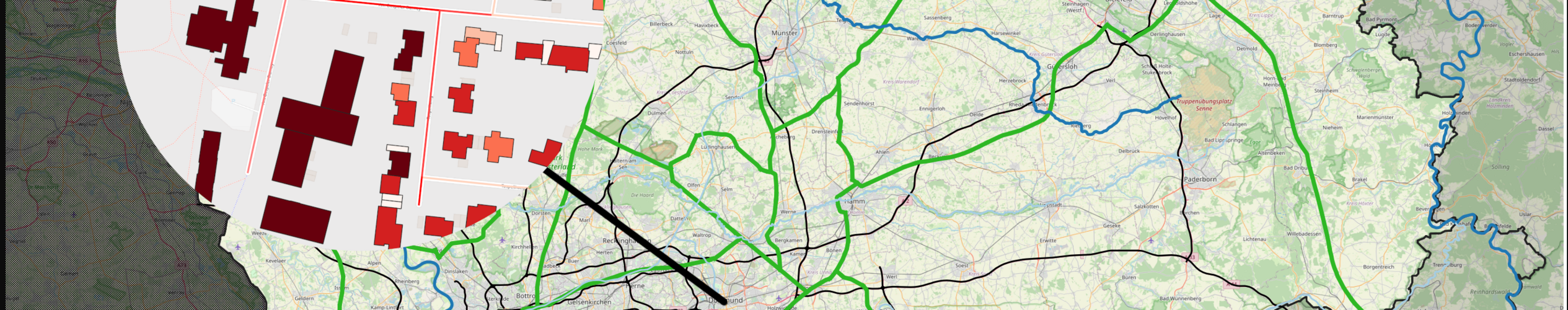
GEOGRAPHIC INFORMATION SYSTEMS (GIS) FOR THE REPRESENTATION OF ENERGY INFRASTRUCTURES AND FOR THE EXECUTION OF GEOREFERENCED ANALYSES

The use of geographical data in the energy sector is essential, and the list of application areas is extensive. Georeferenced data are used, for example, in the planning and design of networks, to carry out geospatial analyses, to prepare for simulations, or to present results. Both data and components of individual energy systems like electricity, gas, and heat, as well as geographical metadata and sociological data, can be depicted and linked. To meet the high requirements and complex questions related to energy systems, GIS represents a central tool at GWI.
GWI develops efficient solutions that not only encompass the collection, aggregation, and management of different data in databases (e.g., PostgreSQL) but also the use of interfaces (e.g., Python). This includes connectivity to simulation or planning programs. Through georeferenced analyses (GIS analyses), real energy infrastructures can be transformed into neighborhood models (Digital Twin) and serve as preparation for simulations with high spatial and temporal resolution. Furthermore, GWI works with geographic information systems to precisely map and analyze the transformation and coupling of energy systems and sectors.
Bildmotiv Seitenanfang: © GWI